Checking for non-preferred file/folder path names (may take a long time depending on the number of files/folders) ...
This resource contains some files/folders that have non-preferred characters in their name. Show non-conforming files/folders.
This resource contains content types with files that need to be updated to match with metadata changes. Show content type files that need updating.
| Authors: |
|
|
|---|---|---|
| Owners: |
|
This resource does not have an owner who is an active HydroShare user. Contact CUAHSI (help@cuahsi.org) for information on this resource. |
| Type: | Resource | |
| Storage: | The size of this resource is 73 bytes | |
| Created: | Sep 28, 2025 at 5:17 a.m. (UTC) | |
| Last updated: | Sep 28, 2025 at 5:18 a.m. (UTC) | |
| Citation: | See how to cite this resource |
| Sharing Status: | Public |
|---|---|
| Views: | 840 |
| Downloads: | 14 |
| +1 Votes: | Be the first one to this. |
| Comments: | No comments (yet) |
Abstract
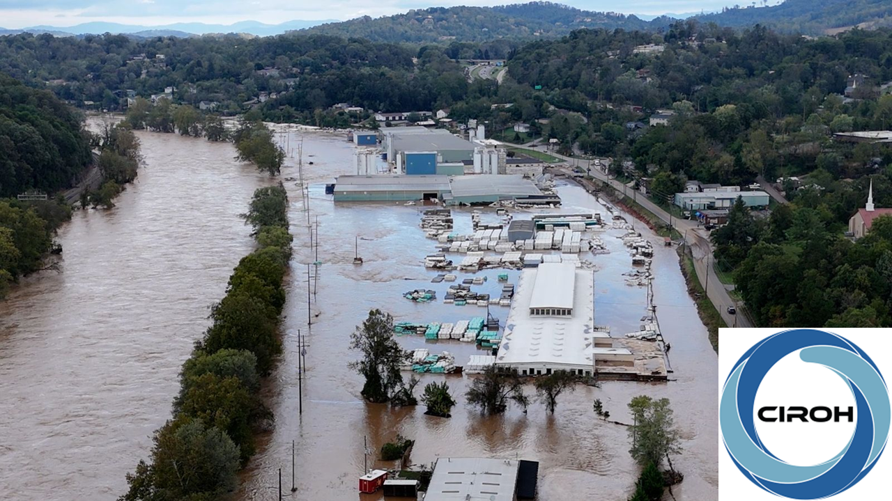
Hurricane Helene, an event that exceeded all expectations, caused extensive flooding in Asheville and its surrounding areas. The unprecedented nature of this event highlighted the critical need for effective tools to assess flood risks and identify high-risk areas. This module focuses on flood inundation mapping and its application in vulnerability assessment. Learners will explore different flood mapping approaches using FEMA flood products and the National Water Model(NWM) to assess flood exposure and high risk facilities.
Subject Keywords
Coverage
Temporal
| Start Date: | |
|---|---|
| End Date: |
Content
Additional Metadata
Credits
Funding Agencies
This resource was created using funding from the following sources:
| Agency Name | Award Title | Award Number |
|---|---|---|
| National Oceanic and Atmospheric Administration (NOAA), University of Alabama | CIROH: Enabling collaboration through data and model sharing with CUAHSI HydroShare | NA22NWS4320003 to University of Alabama, subaward A23-0266-S001 to Utah State University |
How to Cite
This resource is shared under the Creative Commons Attribution CC BY.
http://creativecommons.org/licenses/by/4.0/
Comments
There are currently no comments
New Comment