Checking for non-preferred file/folder path names (may take a long time depending on the number of files/folders) ...
This resource contains some files/folders that have non-preferred characters in their name. Show non-conforming files/folders.
This resource contains content types with files that need to be updated to match with metadata changes. Show content type files that need updating.
| Authors: |
|
|
|---|---|---|
| Owners: |
|
This resource does not have an owner who is an active HydroShare user. Contact CUAHSI (help@cuahsi.org) for information on this resource. |
| Type: | Resource | |
| Storage: | The size of this resource is 51 bytes | |
| Created: | May 20, 2025 at 3:28 a.m. (UTC) | |
| Last updated: | Sep 16, 2025 at 3:10 p.m. (UTC) | |
| Citation: | See how to cite this resource |
| Sharing Status: | Public |
|---|---|
| Views: | 703 |
| Downloads: | 0 |
| +1 Votes: | Be the first one to this. |
| Comments: | No comments (yet) |
Abstract
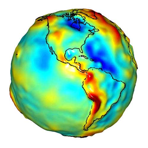
This app produces basic maps and timeseries using data from the GRACE mission.
NASA’s GRACE mission provides the first opportunity to directly measure groundwater changes from space. By observing changes in the Earth’s gravity field, scientists can estimate changes in the amount of water stored in a region, which cause changes in gravity. GRACE provides a more than 10 year-long data record for scientific analysis. This makes a huge difference for scientists and water managers who want to understand trends in how our resources are being consumed over the long term. GRACE has returned data on some of the world’s biggest aquifers and how their water storage is changing [e.g. Rodell and Famiglietti, 2001; Yeh et al., 2006; Rodell et al., 2007]. Using estimates of changes in snow and surface soil moisture, scientists can calculate an exact change in groundwater in volume over a given time period.
A study by Rodell et al. [2009] in northwest India used terrestrial water storage-change observations from GRACE and simulated soil-water variations from a data-integrating hydrological modeling system to show that groundwater is being depleted at a mean rate of 4.0 +/- 1.0 cm yr-1 equivalent height of water (17.7 +/- 4.5 km3 yr-1) over the Indian states of Rajasthan, Punjab and Haryana (including Delhi). During the study period of August 2002 to October 2008, groundwater depletion was equivalent to a net loss of 109 km3 of water, which is double the capacity of India's largest surface-water reservoir.
Subject Keywords
Coverage
Temporal
| Start Date: | |
|---|---|
| End Date: |
Content
Additional Metadata
| Name | Value |
|---|---|
| page_url | https://tethys.ciroh.org/apps/ggst/ |
| thumbnail_url | https://ciroh-portal-static-data.s3.us-east-1.amazonaws.com/7454e07d-f1e2-487e-b595-9e3bccb8ac89.jpg |
Credits
Funding Agencies
This resource was created using funding from the following sources:
| Agency Name | Award Title | Award Number |
|---|---|---|
| National Oceanic and Atmospheric Administration (NOAA), University of Alabama | CIROH: Enabling collaboration through data and model sharing with CUAHSI HydroShare | NA22NWS4320003 to University of Alabama, subaward A23-0266-S001 to Utah State University |
How to Cite
This resource is shared under the Creative Commons Attribution CC BY.
http://creativecommons.org/licenses/by/4.0/
Comments
There are currently no comments
New Comment