Checking for non-preferred file/folder path names (may take a long time depending on the number of files/folders) ...
This resource contains some files/folders that have non-preferred characters in their name. Show non-conforming files/folders.
This resource contains content types with files that need to be updated to match with metadata changes. Show content type files that need updating.
| Authors: |
|
|
|---|---|---|
| Owners: |
|
This resource does not have an owner who is an active HydroShare user. Contact CUAHSI (help@cuahsi.org) for information on this resource. |
| Type: | Resource | |
| Storage: | The size of this resource is 45 bytes | |
| Created: | Jun 02, 2025 at 5:50 p.m. (UTC) | |
| Last updated: | Sep 16, 2025 at 3:07 p.m. (UTC) | |
| Citation: | See how to cite this resource |
| Sharing Status: | Public |
|---|---|
| Views: | 1385 |
| Downloads: | 33 |
| +1 Votes: | Be the first one to this. |
| Comments: | No comments (yet) |
Abstract
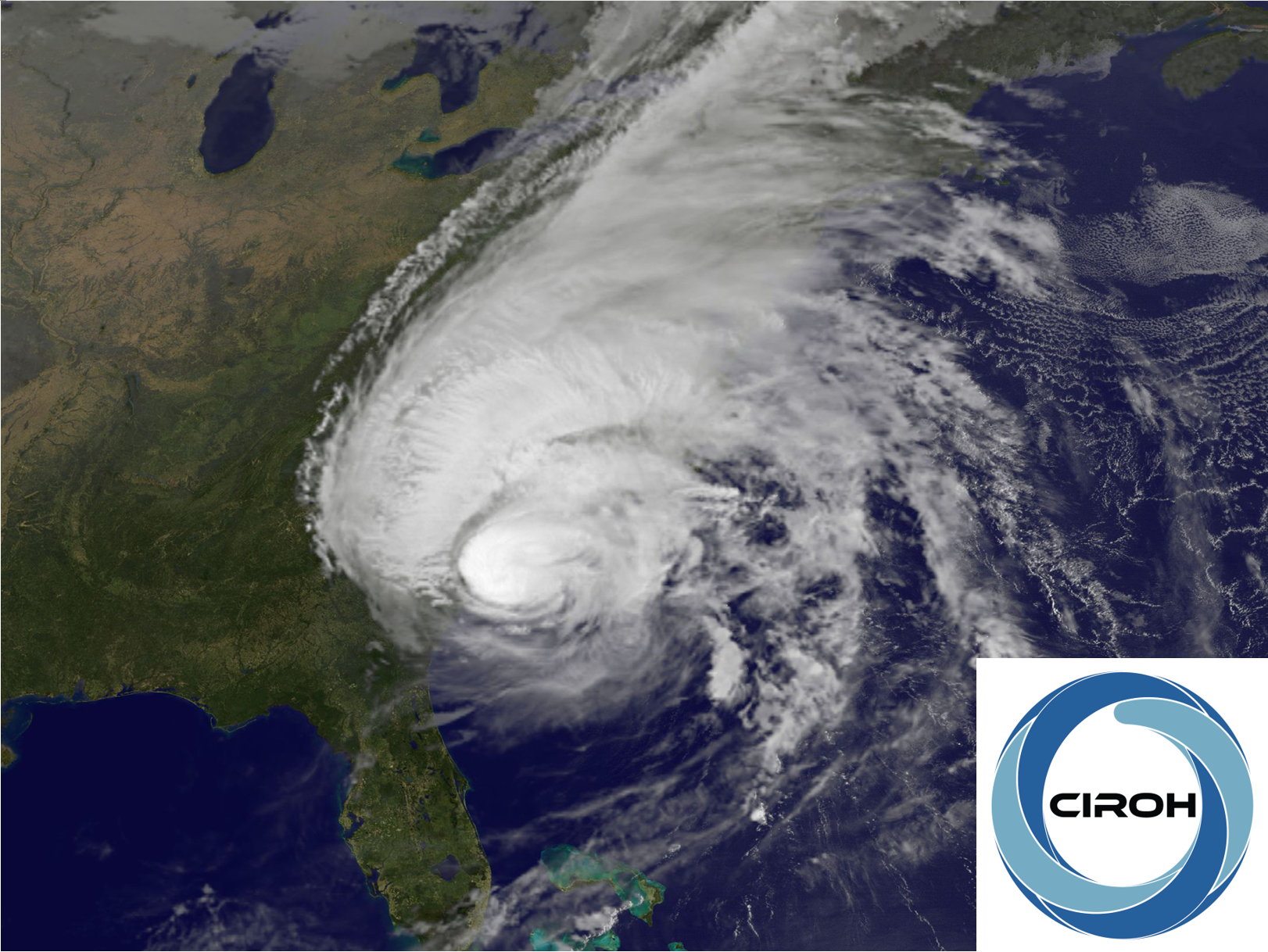
This module will provide you with the basic knowledge to recommend if construction of a community center should proceed considering historical data from previous hurricane impacts near the proposed site. In the first section you will learn how hurricanes form, why they cause flooding and what other impacts they have in coastal communities. In the second section you will learn how to create and analyze report quality time series of hydrologic variables and how to process these time series data to identify different hydrologic processes driving flooding using a python notebook. In the third section, you will be synthesizing all the time series analysis you conducted to support your final recommendation about building the community center.
In this module you will learn about the relationships between hurricanes, groundwater and floods as you assess if it is viable to build a community center in the North Carolina Outer Banks. You will then review the drivers and impacts of hurricanes on the hydrologic system. Specifically, you will create and analyze time series in python to identify the drivers of groundwater level changes. Finally, you will predict potential flooding zones given a coastal topographic map and groundwater level data to evaluate the suitability of constructing a new coastal community center.
Subject Keywords
Coverage
Temporal
| Start Date: | |
|---|---|
| End Date: |
Content
Additional Metadata
Credits
Funding Agencies
This resource was created using funding from the following sources:
| Agency Name | Award Title | Award Number |
|---|---|---|
| National Oceanic and Atmospheric Administration (NOAA), University of Alabama | CIROH: Enabling collaboration through data and model sharing with CUAHSI HydroShare | NA22NWS4320003 to University of Alabama, subaward A23-0266-S001 to Utah State University |
How to Cite
This resource is shared under the Creative Commons Attribution CC BY.
http://creativecommons.org/licenses/by/4.0/
Comments
There are currently no comments
New Comment